 |
|
     |
|
Midford AqueductMonument No: ST 76 SE 313 A Brief History
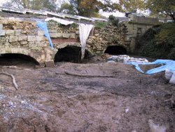
The Midford Aqueduct is the most significant architectural structure on the Somersetshire Coal Canal (SCC). The canal was used to transport coal from pits in the Radstock and Timsbury/Paulton districts to the Kennett & Avon canal, which the SCC joined just to the west of the Dundas Aqueduct at Limpley Stoke. The Midford Aqueduct carried the Radstock branch of the SCC across the Cam Brook, close to the junction between the Radstock and Paulton branches of the SCC. The Radstock branch itself was never fully completed, and a tramway was used instead to transport coal from the Radstock mines to a transhipment point by the Midford Aqueduct. The SCC was unable to compete with the growth of the railways in the second half of the 19th Century. In 1871 the Radstock branch was sold to the Somerset & Dorset Joint Railway, who built a railway line along the route of the tramway. In 1894 the SCC was placed into liquidation, and the canal was closed in 1898. Photo right: Midford Aqueduct before restoration
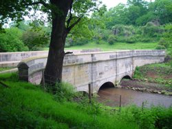
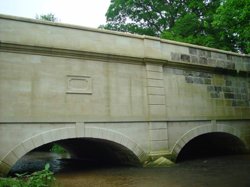
The three arch aqueduct was opened in 1803 and was constructed in a Palladian style from Bath stone ashlar on a rubble core. The stonework had deteriorated since the canal closed, and the aqueduct was in danger of collapsing. Most of the ashlar on the upstream side had either collapsed, or had separated from the core and become extremely unstable. In places the rubble core of the structure had been eroded away to a depth of 2 meters. On the downstream side, the ashlar of the middle arch were missing. The soffits of the arches had suffered from water scour, and the parapets on both sides of the canal flume had vanished. When restoration started it was thought that the aqueduct would not survive another winter. Photo right: Another view of the Midford Aqueduct before restoration ImportanceThe Midford Aqueduct is Grade II listed. RestorationThe Midford Environmental Group (MEG) raised funds and interested other organisations in the aqueduct, and also undertook much conservation work to minimise the deterioration. The AIBT was successful in obtaining a Heritage Lottery Fund (HLF) grant to pay for restoring the structure, and also managed the contracts. The final cost of the restoration was around �1 000 000. Work started in September 2000, with JH Consulting as the architects and St Blaise as the specialist building contractors. The project involved working on a fragile structure that crossed flowing water, and was located in a field at a distance from the nearest road. A coffer dam had to be built to divert the river through the southern arch, allowing work to commence on the two most fragile arches. Subsequently the flow was diverted through the central arch while work continued on the outer arches. Initial stabilisation work included the dismantling of some stonework. Some fallen stones were recovered from the bed of the river, and were tested before re-use. The conditions on the project dictated that a hydraulic lime mortar be used to secure the stonework. That year the rainfall was exceptionally heavy, with four '1 in 50 year' floods and one '1 in 100 year' flood being recorded. The coffer dam was breached 20 times before Christmas, and in January 2001 a decision was made to suspend work until April. Some of the resulting increases in costs were covered by the AIBT's insurers, but the rest had to be met by a successful application to the HLF. Once work restarted in May 2001, the foot and mouth outbreak imposed restrictions on access to the site. These were overcome through the co-operation of the farmer, together with some simple precautions. Work progressed with the better weather, and all the waterside restoration work was completed by October. The final stages involved clearing and repairing the stone lined flume that carried the canal, and restoration of the parapets. The project was finally completed at the end of 2001. The work was highly commended by the judges of the 2002 Natural Stone Awards for its high standard of workmanship under extremely difficult conditions. There is a copy of the AIBT's press release about the completion of the project on the 'Archive' page of the website. Photos above right: Views of the downstream face of the Midford Aqueduct after restoration. Photos by J Hill LocationThe viaduct is located on private farmland at grid reference ST758605, and may also be located on Google Maps using the cordinates: 51.343310,-2.349090. It lies to the south-east of the unclassified road between Midford and Upper Midford, about 200 yards from its junction with the B3110. The nearest bus route passes through Midford.
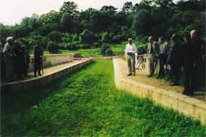
Further InformationFurther information on the Somerset Coal Canal can be found on the website of the Somerset Coal Canal Society. Photo right: View of the opening ceremony in 2002. Photo by M Stacey Page updated 20 Mar 24 |
|
| [email protected] | |


